
Add sections
Artifacts (other than those under heading artifacts) can be displayed on this page to support reflections.
The assessment tasks intriqued me into investigating more. The main reflections are presented in the five blocks.
The assessment task on erosion caused by waves, intriqued me into looking at other types of erosion as well.
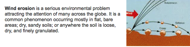
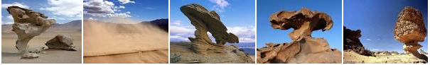
I am sharing a few images to showcase landforms created by wind erosion.
In due couirse, I will also look at the impact of other types of erosion.
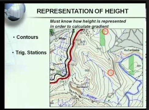
We have learned about using shadows to calculate the height of buidlings on maps. Therefore, I have collected a few photos of the area we have investigated to help me to understand the use of shadows to calculate heights better.
Assessment task 2 dealt with clouds than are associated with rain. since I am always busy taking pictures of clouds, I needed to know more about other types of clouds as well. Here are examples of different types of clouds. I found this image informative.
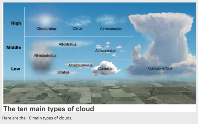
To support understanding, I am also adding the heights:
High clouds - above 23 000 feet
Middle clouds - 100- 23 000 feet
Low clouds - below 7000 feet
Vertically developed clouds (via convection)
In this map, various of the landforms we have dealt with, are displayed.
I have used the map to investigate the flow of the river.
I have learned a lot duirng the course of this year, and I believe I will never drive past anything ithout trying to figure the impact out.
